Snapper Derby, Country Fair postponed due to hurricane

Shelter Island’s annual snapper derby has been postponed from this Saturday to next Saturday, September 3 because of Hurricane Irene.
Also postponed because of the hurricane is the Shelter Island Fire Department’s annual Country Fair, which includes a pig roast, live music, games and contests. Originally scheduled for Saturday, August 27, it will be held next Saturday, September 3 from 12 to 4 p.m. at the Center fire house.
The Shelter Island Historical Society has cancelled a talk planned for Sunday by Timothy Dering on ocean rescue boats.
Union Chapel’s service for Sunday, August 28, at 10:30 has been cancelled.
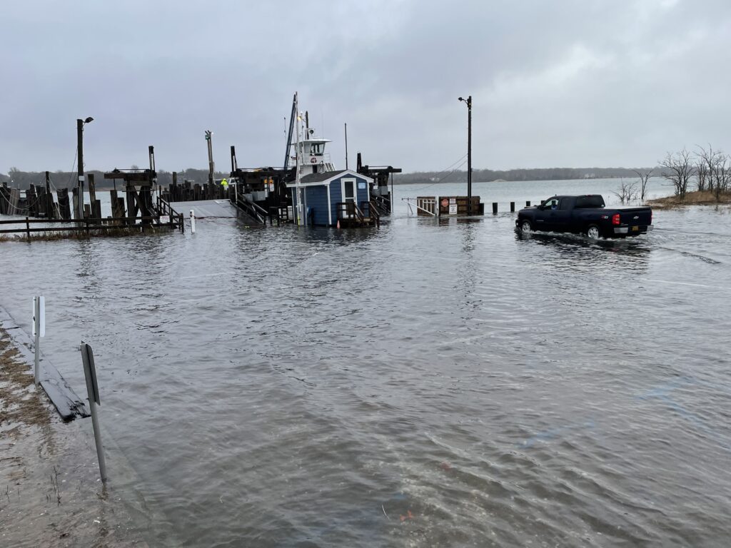
Storm preparations were well underway across the Island. South Ferry crews brought one boat to a safe mooring in West Neck today; a second boat will be taken off line and moored in West Neck tomorrow.
Town officials conducted an emergency planning meeting at Town Hall this morning.
County Executive Steve Levy and Suffolk town supervisors were to brief the media at 3 p.m. today, Friday, on evacuation plans. Low-lying flood prone areas on the south Shore and some on the North Shore are likely to be under mandatory evacuation orders beginning at 8 a.m. tomorrow, according to Mr. Levy’s office.
The only area of Shelter Island that the town might order evacuated sometime Saturday is along Ram Island Drive.
Shelter Island and the entire area from Sandy Hook at the mouth of New York harbor to the mouth of the Merrimack River in Massachusetts are under a hurricane watch issued by the National Weather Service Friday morning. It remained in effect by mid-afternoon.
A watch means that hurricane conditions are possible, with the first effects of tropical storm-force winds likely in about 48 hours.
A hurricane warning is in effect along the coast to the south of Sandy Hook to Little River Inlet in North Carolina, which means a hurricane is expected to hit with the first tropical storm-force winds likely in 36 hours.
The hurricane warning is expected to be extended up the coast as Hurricane Irene moves northward and intensifies today, Friday, from a category II to a category III storm. It is an unusually large hurricane, with hurricane-force winds extending 90 miles from its center and tropical storm-force winds extending 290 miles, according to the National Weather Service.
Although its track is not certain, some computer projections indicate the storm might only brush the North Carolina coast tomorrow and not make its first full landfall until it reaches Long Island on Sunday morning.
The National Weather Service reported at 11 a.m. on Friday the highest sustained winds had decreased from 110 to 105 mph and predicted Irene would pass close to or over the North Carolina coast tomorrow (Saturday) night.