
Shelter Island bracing for Sunday blizzard
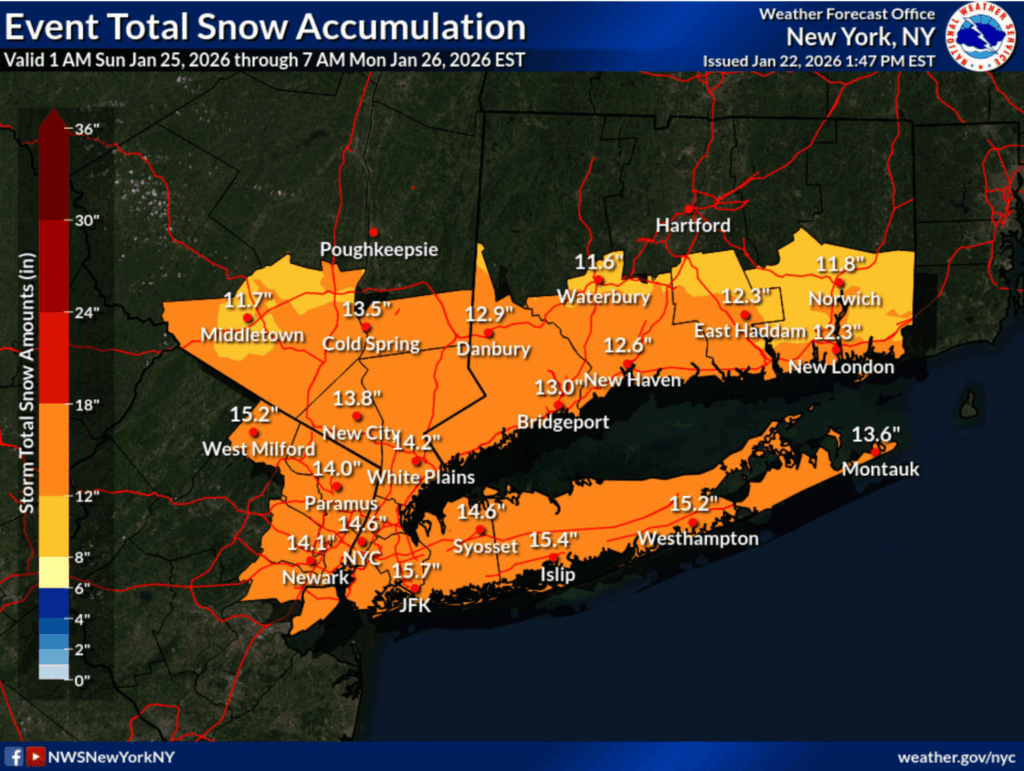
The worst snowstorm in four years, with up to a foot of snow expected to fall from early Sunday morning through Monday morning is on track for Shelter Island.
The National Weather Service issued three advisories for the region on Thursday — including a winter storm watch for all of Suffolk County — warning of hazardous travel conditions, potential power outages and near-whiteout conditions.
Forecasters predict between six and 12 inches of accumulation, with snow expected to develop early Sunday morning and become moderate to heavy by Sunday afternoon.
“Roads, and especially bridges and overpasses, will likely become slick and hazardous. Visibilities may drop below one-quarter mile in heavy snow,” the advisory reads.
The heaviest snowfall is forecast for Sunday night into Monday morning.
The wintry blast is expected to arrive Friday night, sending temperatures plummeting into the single digits. Saturday’s high will reach only the mid-teens.
Suffolk County sent out a weather advisory Thursday at 12:45 p.m. for late Saturday night through Monday afternoon.
Shelter Island Police Chief Jim Read, who is the Emergency Management Coordinator for the Town, will convene a meeting on Friday of Town and first responder officials to map a strategy for the coming storm. The Reporter will also be in attendance and bring more on the event in future posts.