Weather Service: Snow, freezing rain done by noon, brutal cold coming
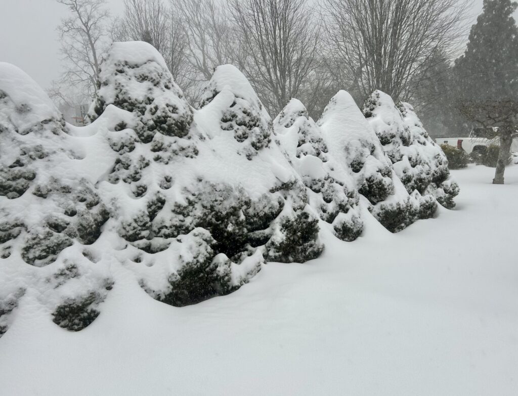
It seems Shelter Island weathered a severe winter storm that dumped as much as 20 inches of snow in places from Sunday morning into the wee hours Monday, according to Highway Superintendent Ken Lewis Jr.
Police Chief Jim Read, at 5:30 a.m., said there had been no emergencies. There were a couple of fire calls and an ambulance call, the chief said, but no injuries or damage. “I give them credit for the quick responses,” he said.
As of 5:45 a.m., PSEG was reporting that there were no power outages on the Island.

Mr. Lewis said at 7 a.m. that it had been a long but successful night clearing Island roadways. “There were no downed trees and people took the advice to stay home,” which made the department’s job a bit easier, he said. “The main roads are good and most of the sideroads are passable. We were out until 4 this morning and we’ll be out later this morning after the guys get a break.”
The National Weather Service (NWS) has kept its Winter Storm Warning in effect until 1 p.m. today, Monday, Jan. 26. A Winter Storm Warning is issued by the NWS when a significant combination of hazardous winter weather is occurring or imminent, and/or there is enough ice accumulation to cause damage to trees or powerlines.

The NWS is forecasting a chance of snow before 9 a.m. Monday and then chances of snow and freezing rain between 9 and 10 a.m.
It will be cloudy, with a high temperature right at the freezing mark of 32 degrees. With a north wind at 6 to 9 mph, and shifting to the northwest in the afternoon, gusts could reach 20 mph. The wind chill values for today, estimated by the NWS, is between 15 and 25 degrees.
Tonight, skies will clear and the temperature will drop to 15 degrees. With a blustery northwest wind at 16 to 20 mph, the wind chill will be between zero and 10 degrees, according to the NWS.